

In the early-1920s, in addition to assigning the majority of streets numbers and creating a unique hyphenated house numbering method, the Queens Topographical Bureau also designated several major routes as “Boulevards.” Vernon Ave. became Vernon Blvd., Farmers Ave. became Farmers Blvd., and so on. Jackson Ave. and Broadway were combined to create Northern Blvd., which has also taken over Route 25A, North Hempstead Turnpike, in Nassau County (despite it running through the entire Town of North Hempstead). This got the gears turning on my head and using Google Street View instead of bus fares and Adidas, I gathered most of Queens’ lesser “Boulevards.”
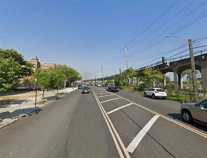
I’ve been on the Rockaway peninsula just a handful of times since founding forgotten-ny.com in the late-1990s, but I visited more often in the 1970s and 1980s when I bicycled in from Bay Ridge. It’s fairly easy to get there as I traveled to Sheepshead Bay, across the Marine Parkway Gil Hodges Bridge (which I dislike along with the Triborough because of its low guardrails) and there I was at Fort Tilden. From there I was easily able to bicycle east down Rockaway Beach Blvd. and Beach Channel Dr.
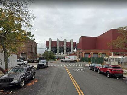
I must’ve encountered Amstel Blvd., which issues west for a few blocks from Beach Channel Dr. at Beach 70th St., coming to a dead end west of Beach 75th. It’s mostly home to auto repair shops with a few scattered houses, though I was fascinated with this multi-windowed, sea-green glass garage.
We’ll stay on the Rockaway peninsula for this one. The community of Arverne is located just east of the A train bridge crossing Jamaica Bay. A relatively new development, Arverne By the Sea, appeared about two decades ago on the south shore facing the Atlantic Ocean, but the remainder was built up around the turn of the 20th century by Remington Vernam, whose signature “R. Vernam” inspired the name.
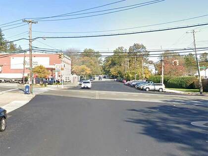
Arverne Blvd. is busy, but short, running from Beach 54th St. west to Beach Channel Dr. at Beach 62nd St. East of Beach 54th, Rockaway Beach Blvd. takes over its route north of the IND A train tracks, while Edgemere Ave. takes over for Rockaway Beach Blvd. south of the tracks. How this complicated situation arose is a mystery to me.
We move from Queens’ southern frontier to its northern edge in Astoria, where Berrian Blvd. runs a few blocks from Steinway Street east to a parking lot for LaGuardia Airport employees east of 45th St., taking the place of 18th Ave. It borders a sewage treatment plant, but it’s also in view of the Steinway Mansion, an 1852 building home to generations of people associated with the landmark Steinway Piano factory.
The boulevard is named for the colonial-era Dutch immigrant family the Berriens, whose scion Cornelius Jansen Berrien, Sr. purchased an island in the East River in 1727, where he and his descendants lived. The island was attached to Astoria by landfill and is now home to a massive Con Edison power plant.

Visitors unfamiliar with southeast Queens will find a sweeping, green oasis in Baisley Pond Park, which sits on an irregular plot between Foch, Sutphin, Rockaway and Baisley Boulevards. The park’s 110 acres offer baseball, softball and cricket fields in its southern extension between Rockaway Blvd. and the Belt Parkway, children’s playgrounds, catch and release fishing in its large peaceful pond, and benches to laze on.
Today’s Baisley Pond, named for a mid-19th century farming family on whose land the pond was created, first appeared in the 1850s. When Brooklyn’s civil engineers were dredging the pond to make it deeper, remains were found of an American mastodon including five molar teeth and a bone fragment, which were decades later dispatched to the American Museum of Natural History. The massive shaggy elephant-like creatures frequented southern Queens up until 10,000 years ago. The reasons for their disappearance are still debated, but likely have something to do with changing climate and the appearance in the area of the world’s most feared hunter—man.
Meanwhile, in the 21st century, you can find Lakeview Boulevard East at the park’s eastern end between 118th and 122nd Aves. There’s no Lakeview Boulevard West and I’m not sure there ever was one; its spot is filled by 155th St.
Nassau Blvd. runs northeast from the Long Island Expressway near 254th St. into Nassau County, where it becomes Horace Harding Blvd. It’s all that remains of a much longer surface route constructed in the 1930s, Nassau Blvd., subsequently renamed Horace Harding Blvd. for a Robert Moses aide. In the 1950s, the road was developed into the Long Island Expressway. This is a short section that diverges from the main LIE as it pushes east.
Probably the strangest of Queens’ minor boulevards, Powell’s Cove Blvd. was once mapped by the city to run along the East River from 15th Ave. all the way north and east along the East River to Cryder’s Point near the Throgs Neck Bridge, but only some of it was built. Nonetheless it runs from College Point all the way to Whitestone in six separate surviving sections. In College Point it runs in a semiprivate area between 121st St. and Lax Ave., where private street signs call it “Powell Cove Boulevard.” Powell’s Cove itself is an inlet in the East River west of the Whitestone Bridge. The lengthiest and most attractive section of Powell’s Cove Blvd. runs from 154th St. east to Cryder’s Point.
Kevin Walsh is the webmaster of the award-winning website Forgotten NY, and the author of the books Forgotten New York (HarperCollins, 2006) and also, with the Greater Astoria Historical Society, Forgotten Queens (Arcadia, 2013)